Who really were the “ruler” guys that drew the Canadian border? Trump doesn’t know.
(long read)
When US President Donald Trump is not demanding that Canada become “the 51st state” he muses about redrawing a border, a border that is defined by treaties dating back to 1783.
In mid-March Trump, in a media scrum outside the White House, talked about redrawing the border.
In Trump’s derailed train of consciousness, according to reports, he repeated himself.
“If you look at a map, they drew an artificial line right through it, between Canada and the U.S., just a straight artificial line. Somebody did it a long time ago, many, many decades ago,” he said.
And
“When you take away that artificial line looks like it was done by a ruler and that’s what it was, some guy sat down years ago and said that and it makes no sense.”

So, Who were those guys?
Of course, the 49th Parallel border makes sense. What was, until recently, the world’s longest undefended border along the 49th parallel was first defined in a treaty, The Convention of 1818, between the United States and Great Britain, then the colonial power.
It wasn’t just “some guy” as the most ignorant president in American history stated. The boundary was defined by distinguished diplomats and parliamentarians.
So, who were those guys?
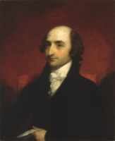
On the American side one of the negotiators was Albert Gallatin a former member of both the House of Representatives and Senate, a former Secretary of the Treasury, founder of New York University and at the time of the negotiations, United States Ambassador to France.
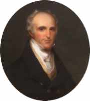
The second American negotiator was Richard Rush, who was then the United States ambassador to Great Britain. Rush had been Attorney General of the United States as well as acting Secretary of State.
One of the British negotiators was Henry Goulburn, a wealthy conservative politician who as a Member of Parliament who had held cabinet positions as Under-Secretary of State for Home Affairs, and Under Secretary of State for War and the Colonies.

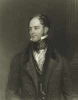
The second British negotiator was a Frederick J. Robinson, from a wealthy land owning family, also a member of Parliament. He had served on a diplomatic mission to Austria, was Vice-President of the Board of Trade, joint-Paymaster of the Forces and member of the Board of Admiralty and a future Prime Minister of Great Britain.[1]
Donald Trump, as he shows so often, doesn’t know what he’s talking about. A future prime minister is hardly a guy with a ruler. Neither are a Secretary of State and Secretary of the Treasury. So, having established that the 49th parallel wasn’t just some guy with a ruler, what was it all about?
The 49th Parallel
The 1818 treaty was negotiated four years after the War of 1812, to ensure that the boundary was defined, an issue that had not been really addressed in the Treaty of Ghent that ended the war. During those peace negotiations, it was the United States that had proposed the 49th Parallel. At the time the idea was postponed.
A hundred years earlier, in 1714, the Hudson’s Bay Company (in 2025 in bankruptcy), had been the one with “the ruler.” The original charter of the Hudson’s Bay Company granted the company a trading monopoly on behalf of England over land drained by all rivers and streams flowing into Hudson Bay.
It was in 1714 that briefly, the fur trading company for economic reasons, had limited its operations to north of the 49th parallel. That limitation did not last, both Hudson’s Bay and the rival Northwest Company expanded their operations well south along the Missouri and Mississippi Rivers and west to the Pacific Coast.
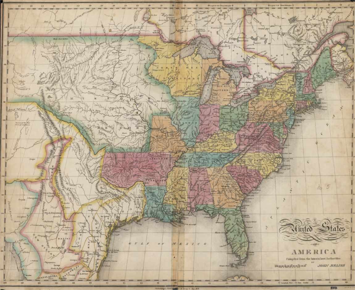
The question of who would control the territory became more complicated with the Louisiana Purchase in 1803,which ceded French control to the United States in the areas drained by the Missouri River. Some tributaries begin north of the 49th Parallel. There is one river that is different, the Red River which originates in what is today Minnesota and North Dakota, flows north to Lake Winnipeg and into Hudson Bay. That made the Red River part of the land chartered to the Hudson’s Bay Company.
In 1818, both the United States and Great Britain wanted to maintain peace and friendly relations so both sides were prepared to give something up.
The first treaties
The Treaty of Paris, 1783 ended the Revolutionary War and defined the boundaries of the new United States at a time when not much was known about the western territories home to indigenous nations. The treaty confirmed that Great Britain had jurisdiction over land on the northern shores of the Great Lakes, something Donald Trump and his advisers now are challenging. The New York Times reported (paywalled) Commerce Secretary Howard Lutnik “wanted to tear up the Great Lakes agreements and conventions between the two nations that lay out how they share and manage Lakes Superior, Huron, Erie and Ontario.”
The treaty with Great Britain granted US jurisdiction over the land east of the Appalachians to the Mississippi River. The northern border was set at “most northwesternmost point” of the Lake of the Woods, which had not been fully explored or mapped. It assumed that the Mississippi reached that far north which it doesn’t. That was one of the mistakes that had to be ironed out in 1818.
The Treaty of Ghent, 1814 ended the War of 1812 and returned all boundaries to the way they were prior to the United States Declaration of War, leaving the need for the Treaty of 1818 to clear everything up.
Convention of 1818
In 1818, Great Britain called an international convention aimed at clearing up issues that were neglected or untouched among nations in the previous decades of war. One set of negotiations was between Britain and the United States to formalize the border with what would become Canada and some related fishery issues. The surveys had improved in the past several years so both sides had somewhat more accurate maps. Both sides had to give up some land. The northernmost portion of the Louisiana Purchase, north of the 49th Parallel was ceded to Great Britain consisting of the upper reaches of the Mississippi Missouri watershed Milk River, Poplar River, and Big Muddy Creek would today be part of Alberta and Saskatchewan. Former parts of the Red River Colony and Hudson’s Bay’ s Rupert’s Land became part of the United States today parts Minnesota, North Dakota, and South Dakota.
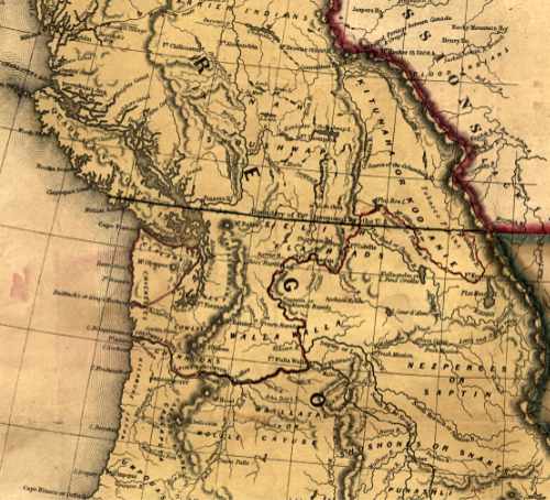
West of the Rockies, what became known as the Oregon Territory, was to be under joint control for the next ten years.
The Rush Bagot Treaty
The Rush Bagot treaty was negotiated in 1817 between Rush and the British ambassador to Washington, Sir Charles Bagot, then concluded as part of the negotiation for the 1818 convention. The treaty demilitarized the Great Lakes and Lake Champlain. It allowed both the US and Britain to maintain two and only two small naval vessels on the lakes. The Rush Bagot treaty began the idea of the “longest undefended border.”
The Webster Ashburn Treaty
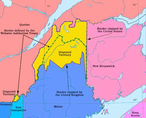
After William Lyon Mackenzie’s failed uprising in Lower Canada and Louis-Joseph Papineau’s similar rebellion in Lower Canada both in 1837, there were border conflicts, mostly carried out by Americans who believed they were “liberating” Canada from “British tyranny.” In Upper Canada, the attacks by self-styled American “Patriots” became known as the Patriot War, which is one of my current writing projects. You will find updates on my newsletter at ravencoast.substack.com. The other dispute was over the boundary between Maine and Quebec and New Brunswick. It is sometimes called the Aroostook War although there minor skirmishes, there was no actual combat, even though Congress did authorize the mobilization of American soldiers.
At the time of the 1837 rebellions in both Upper and Lower Canada, the United States government did not want to get into a new war with the Great Britain and then President Martin van Buren
declared the nation neutral and his administration took measures to enforce the country’s Neutrality Act.
The potential conflict did give both sides the motivation to resolve border issues. The negotiators were the American lawyer and statesman Daniel Webster, then the Secretary of State and Alexander Baring, 1st Baron Ashburton, former Member of Parliament newly appointed to the House of Lords, as a special envoy.
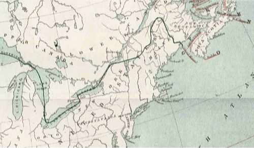
The trickiest negotiations were over the boundary with Maine, which had seceded from Massachusetts n 1820 to become its own state. The boundary had been defined by the Treaty of Paris in 1783. Both the area to the north somewhat toward the St. Lawrence River and east to the Saint John River were disputed in area of mixed settlers including British, American and Acadians. The economic returns from the valuable timber industry increased the tensions.
In Maine, the result was a compromise, in effect dividing the northern part of Maine in half. Britain retained the region along the St. Lawrence River and gave up its claim to the rest of the state. The treaty also clarified the border in the area of the Lake of the Woods and reaffirmed that the 49th Parallel was the border across the prairies to the Rocky Mountains. The two diplomats postponed any discussion of the Oregon Territory.
The Oregon Treaty
The early European settlers from four nations all claimed the Pacific Northwest, Spain, Great Britain, Russia and the United States (all, of course, ignored the indigenous people).
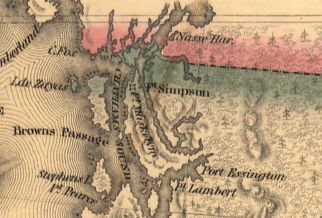
The Russian had their own trading forts and ports along the Pacific Coast. In 1824, the United States signed a treaty with Russia and in 1825, Britain signed a similar treaty recognizing the coastal border of “Russian-America” was at latitude 54°40′N and east to 141 Longitude.[2] That today is the southern tip of Prince of Wales Island and the boundary of the Alaska Panhandle.
American settlers were beginning to flood the west and tensions again led to threats of war. The boundary was also an issue in the 1844 presidential election. James Polk’s proposal was the 49th Parallel. The slogan 54-40 or fight was an issue that emerged after the election. Some American politicians wanted to annex the territory all the way to the Russian territory. The British wanted the boundary to be set based on the bank of the Columbia River.
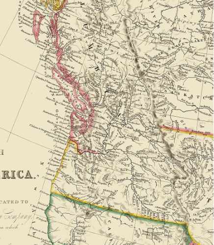
When James Polk who became president, the United States was under threat of war with Mexico over the annexation of Texas. To avoid a two front war, Polk formally proposed the 49th Parallel. After much rangling the Oregon Treaty was agreed in 1846 just as the Mexican- America war broke out, which helped both the agreement and ratification. The 49th parallel was extended to the Pacific Coast and then extended to south of Vancouver Island. A further dispute over the San Juan and Gulf Islands was settled by arbitration in 1872.
Confederation
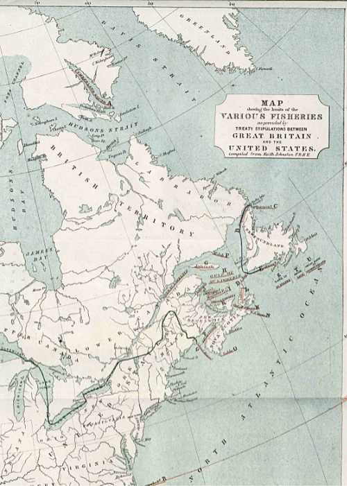 With Confederation and Canada becoming a Dominion of the British Empire, Canada gained some responsibility for the border’s treaties. In 1866, Britain and the United States negotiated a fisheries agreement, that clarified where each nation’s fisher could operate and confirmed the existing border.[3]
The Alaska Boundary
The Alaska Boundary dispute has always been a sore point in Canadian history. Beginning with the Klondike gold rush and again with poor maps, there was uncertainty where the boundary of the Alaska Panhandle was to the east. The issue was settled by arbitration, with a six-member tribunal, three Americans, two Canadians and one British. The British member eventually sided with the Americans. Once again the outcome in 1903 was a half and half compromise along the eastern mountains. That meant that the Yukon and Canada were denied a port on the ocean and some of the islands in the Portland Channel that British Columbia wanted were part of Alaska. The Alaska Boundary dispute is regarded as key point in the rise of Canadian nationalism. Canada felt betrayed by Britain. That strengthened the movement for more independence from Britain. Nor was Canada that happy with the United States. The outcome of the dispute was a factor in Canada rejecting free trade with the United States in the election of 1911.
The 1908 Treaty
Scholars and other experts have wondered what Donald Trump sees in the 1908 treaty between Great Britain and the United States. The agreement was basically a housekeeping measure, where the more modern surveying technology and techniques were available to make a definite survey of the border from “the Atlantic Ocean to the Pacific Ocean.” That agreement led to the establishment of the International Boundary Commission in 1925.
Water
There are two agreements between Canada and the United States over water. The 1909 Boundary Waters Treaty governs the practical uses and conservation of water along the borders and created the International Joint Commission that deals with any water issue on the boundary. The Columbia River Treaty was agreed in 1961, to manage flood control and hydro-electricity generation. Serious negotiations began after devastating floods in British Columbia, Washington and Oregon in 1948. The treaty also called for BC to build three dams in the province and for one to be built in Washington. The treaty has no end date, but there were provisions for renegotiation or termination with talks to begin 2024. In March, the Trump administration put the negotiations on hold, during a time of rising tariffs and Trump’s repeated assertions of annexation. In the United States, the Bonneville Power Administration governs the use of flood control and electricity. There are numerous reports that the Bonneville staff have been purged by Elon Musk’s DOGE, but details are sketchy and unconfirmed.
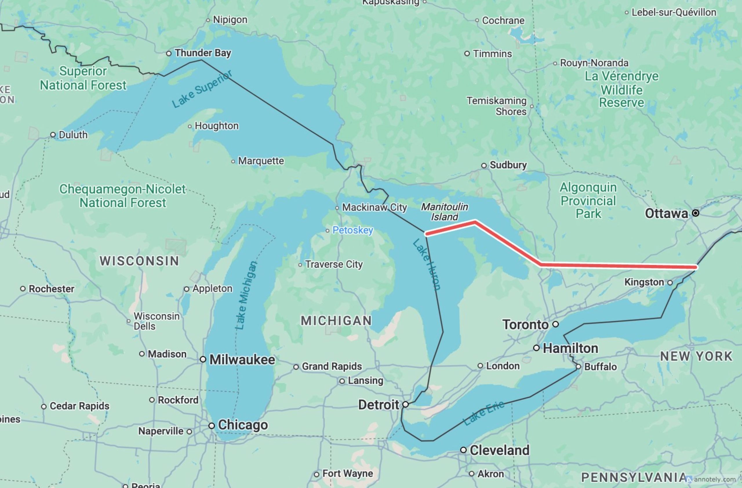
Where did this map come from?
A map circulating on social media purports to show one of the proposals for a United States taking over the more prosperous parts of Ontario. The origin is uncertain. Just compare it with the 1866 map that showed the boundary prior to Confederation.
So that’s a brief factual history of how the Canada-United States border came to be. You have to wonder, as far as the contemporary United States is concerned, whether treaties and laws matter in any way to Donald Trump and his cabinet of mediocraties and reactionaries. The Trump adminstration now appears to be in a war with the United States Constitution, the seperation of powers and the courts. Trade agreements and other international treaties are scorned and ignored.
For Canada, on the the hand, it is a matter of national sovereignty and independence. We are masters in our own house (maitre chez nous)
__________________
[1]. Later as Viscount Goderich, in 1827, he became the prime minister with the third shortest time in office, 131 days, after succeeding George Canning who died in office after 119 days, leaving Liz Truss the worst at 49 days. At least Goderich served longer than the shelf life of a head of lettuce.
[2]. My home in Kitimat. BC is at 54.0554N. Prince Rupert. BC is at 54.1846 N.
[3]. “FO 881/2636: United States: Memo. North American Fisheries. Map and Appendix. 1782-1866. (Mr. A. S. Green).” UK: The National Archives:
Related Links
‘Artificially drawn line’: The border and Trump’s plan for Canada
CBC News Video
U.S. President Donald Trump has repeatedly said he wants Canada to be the 51st state and has reportedly questioned the validity of the border citing a little-known 1908 treaty. CBC’s Eli Glasner breaks down the latest threats with experts who compare Trump’s strategy to a game of Risk.
Convention of 1818 Canadian Encyclopedia
US State Department web page on historic border negotiations (retrieved March 20, 2025 in case it is taken down)
Text of the 1818 Convention from Yale Law School
CBC News Feb. 7, 2025
NATO Chief Silenced by Trump’s Bonkers Canada Rant
Yahoo News March 13, 2025
Trump Intensifies Statehood Threats in Attack on Canada
New York Times March 12, 2025 (paywalled)
White House official threatens to redraw Canadian border
Daily Telegraph (paywalled) February 27, 2025
Trump Aide Reportedly Threatens to Redraw U.S.-Canada Border
Yahoo News Feb 27, 2025